Saturday, November 29, 2008
Friday, November 28, 2008
Monday, November 24, 2008
Cold Springs Trail Open....Again.
Sunday, November 23, 2008
Mountain Drive Flood Prevention Day Photos
I was assigned to a group of properties on E. Mtn Drive where none of the 10 or homes were left standing. We met with one of the homeowners who directed us on how to protect the properties and creeks from flooding. While talking with her we about the fire she told us how there was 15 minutes to get out with everything including her 2 daughters. Her neighbors were not as lucky, they are the two burn victims still being treated for their injuries. This property is almost the next door neighbor to the Tea Gardens but in a canyon so the flames would not have been visible until they were right on top of her. Interesting to know that as she was evacuated fire engines lined the road and were unable to do anything to fight the massive flames. It is one thing to see the photos in the newspaper or even drive by one of these burnt down homes but it is another to actually see them up close. Some of the properties in our zone still contained personal items in the rubble, obviously the homeowners had not gotten a chance to sift through what was left.
Back to the reason we were all there. The main task was to prevent erosion and flooding of those who live near the watersheds down below. The plant life gone prevents any absorption of water and the creeks simply can not contain the amount of run-off. We lined the driveway with sandbags, dug ditches for silt fences, and created diversions in the creeks. It was a huge amount of work even with a good sized crew of about 15. When looking to neighboring properties the same task was occurring up and down Mtn Drive over and over again. Good work to all those who helped out and lets hope we helped prevent some major problems this winter.
Still Smoldering
Saturday, November 22, 2008
Help The Mountain Drive Residents Prevent Flooding! 11/23/08
Friday, November 21, 2008
More Trail Closures- Cold Springs
Wednesday, November 19, 2008
Goats are on Tunnel Trail!


First Look Post Tea FIre: Parma Park, Cold Springs Trail, Rattlesnake Cyn

Parma Overview from W. Mtn Dr.(Permission to enter this area by SBPD)
West Mountain Drive
Parma Trails
Parma Fire Road

Parma Hillsides and above W Mountain

Picnic area still standing!

Cold Springs Trail- Of the three trails affected, Cold Springs had the least amount of damage. The fire primarily stayed to the west of Cold Springs Cyn due to the winds and from the help of fire fighters. The lower part of CS Trail up to just past the West Fork seemed to be the only affected areas. At the time that the photos were taken the West Fork was still closed.
Cold Springs Trail Head(west side of creek)
Cold Springs Main Trail where the fire stopped

Phos-Chek coated sign at the juncion

Phos-Chek coated rocks in the creek from aircraft

Warning at the W Fork

Tea Gardens
Hillside above West Fork(note- the fire did not continue up towards Tangerine Falls or the trail to Gibralter)

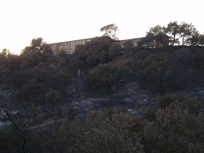
Rattlesnake Canyon Trail- The Lower part of Rattlesnake was burnt up pretty good. The fire burnt down the hill from the monastary up to St Marys Seminary and down the canyon a few hundred more yards. For about 1/4 of a mile the trail is burnt on both sides really leaving the trail in a unrecognizable state. From that point up until the next creek crossing the fire primarily stayed on the east side above the trail. It does not appear that there is much if any damage past the second creek crossing except on upper hillsides. This trail is closed at the time of this posting.
Rattlesnake Trail Head

St Marys Seminary

Rattlesnake Trail(photo taken from adjacent property)

Fire Fighters still working hot spots in RS and Skofield Park
Saturday, November 15, 2008
Tea Fire Perimeter as of 11/15/08
http://www.countyofsb.org/uploadedImages/ceo/oes/EvacAreasWeb_111608_11x17_update_1600_hrs.jpg
Friday, November 14, 2008
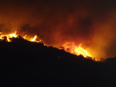
Tea Fire Photos From Parma Park
Thursday, November 13, 2008
Mountain Unicyclists in the News Press
Wednesday, November 12, 2008
Talk About A Shitty Task
Saturday, November 8, 2008
Ladybug Feeding Frenzy on Romero


