Showing posts with label Front Country Trails. Show all posts

Monday, January 8, 2018

Thomas Fire Front Country Trail Closures Demystified

The Thomas Fire has effected every one from our local communities in one way or another.  From the devastation seen through entire neighborhoods to the loss of life, it is was an event that shall not be forgotten any time soon.  The smell of smoke when one ventures nears the burn zone and those fiery images will be engrained in all of our memories for a long time to come.  Our condolences go out to anyone effected by this fire. 

And then there was the mass destruction to the vegetation on hills and mountains between Santa Paula and Santa Barbara.  The Los Padres National Forest has never seen anything of this size or this amount of destruction before.  Trails and roads across the entire forest have been compromised and will continue to be unsafe especially with loose hillsides that will fell rock and debris after every rainstorm.  The recovery will take years as we have seen with the much less severe Jesusita Fire, but eventually things will return level of normalcy.  Then there is the high potential for flooding across areas where the watersheds were stripped of growth......

When will the trails re-open?

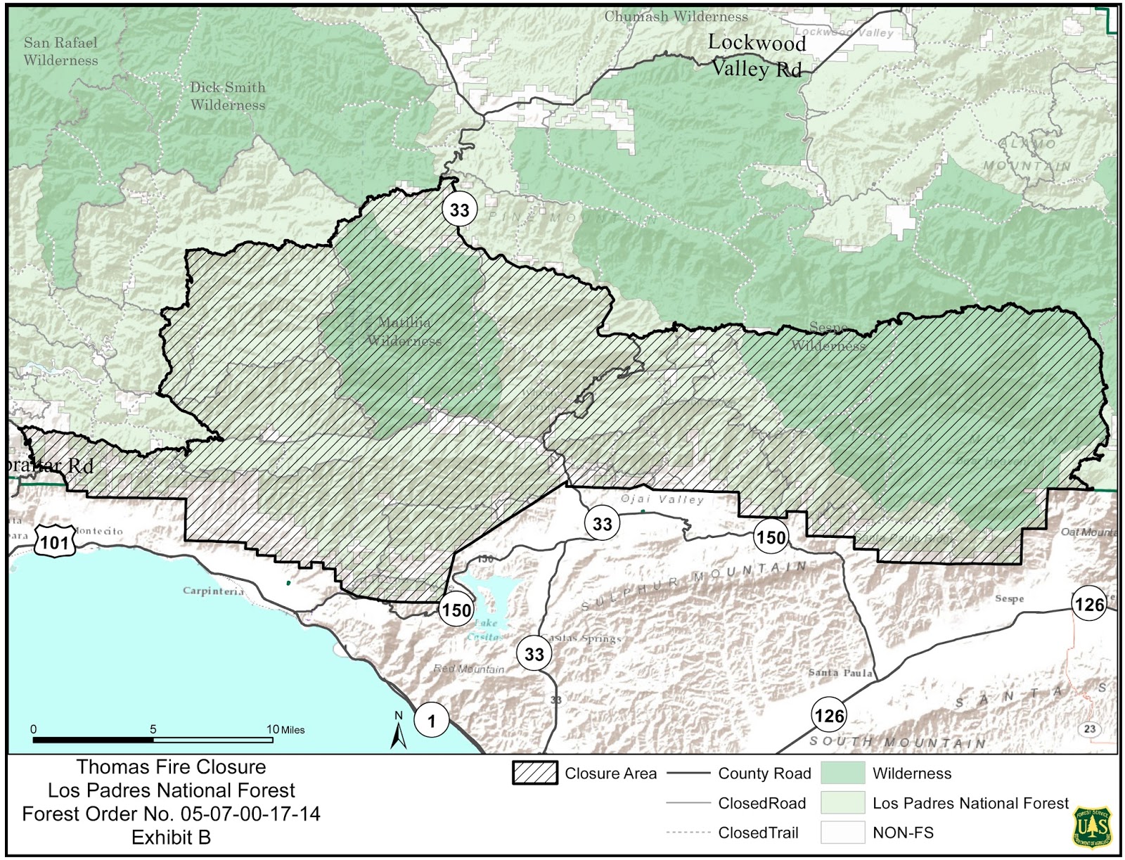
The good news is that all Front Country Trails West of Gibraltar Road have re-opened, however those to the east of Gibraltar Rd. including Franklin Trail have been closed off if not in their entirety, to a significant degree.  The Forest Service Closure Order and Map outlines these closures, which states that within the National Forest, in areas that were effected by the Thomas Fire are now closed.  Further clarified, certain trails have trail heads which begin outside the forest and then enter and are closed at the entry point.  Official trail closure signage has now been placed at all trail heads indicating "closed" or "closed ahead" with additional closure signage at the forest boundary line, and the FS has begun routine patrols of these areas.   Those trails effected by this closure order are Cold Spring, Hot Springs, Mcmenemy, San Ysidro, Buena Vista, Old Pueblo, Girard, Saddle Rock, Romero, and Franklin Trails.  Cold Spring(Main entrance) and Romero begin within the National Forest and are closed off in their entirety,  however some other trails the distance between the trail head and NF boundary can vary from a few feet to as much as 3/4 of a mile as in the case of Franklin Trail.  The county of Santa Barbara is aware of this and considering further closures to narrow the gap.  This photo album with maps of effected trails highlights trails along the front country and where they close/cross into National Forest Land.  

As to when the trails east of Gibraltar Road will re-open, no firm date was given by District Ranger Smith, only that it would be after the rainy season has ended and the trails have been evaluated for safety.

Is there a trail you were wondering has re-opened and didn't see it listed here, contact the local ranger station to find out as trail status in some areas this may change throughout the winter: (805) 967-3481


How can you help?  

First and foremost, stay off the trails that have been closed to public access and resist the urge to visit areas where water/debris flow is likely to be high during and after rain storms.   As for trail maintenance projects, none are permitted at this time by any local organizations on Forest Service lands within the closure and the only assistance the FS has asked of local groups is to help place closure signs and notices and help get the word out to trail users as to the trail status.  Some consulting on terrain across the front country has also been asked of local groups and trail maintenance projects will continue on OPEN trails throughout the winter as storms wreak havoc.  Contact one of many local trails organizations for any events planned on OPEN trails, not only on the Front Country but throughout the LPNF.  The FS is in the process of bringing in specialized trail crews to help divert water from trails thus preventing mass erosion on trails effected by the Thomas Fire.


P.S.  The FS let trail organizations know they are monitoring Facebook and aware of the trespassing/posting of photos on closed trails!

Saturday, March 11, 2017

Jesusita Trail : Rut Redemption and Drainage Problem Eradication

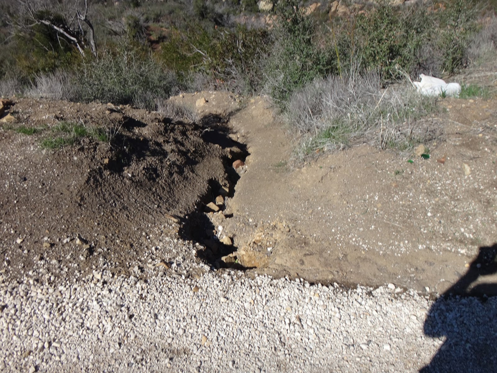
This area on Jesusita Trail took a beating from high water flow and lack of drainage.  A rut was the predominant feature of this trail after the storms causing users to straddle it when climbing or descending the hill.  Solution: create drainage to keep water from rutting out the trail further, fill in the rut, and make a path that is more sustainable and long lasting.

The rut looking uphill

Looking downhill, water followed  the center line of the trail

Joani building the substructure for the water drain

Chase and Joani working on the trail's new path

Finished product, the rut filled in and the trail much more sustainable

The view looking downhill, a massive water drain will prevent rutting for years to
come while the direction of the new trail avoids the "fall line" and is much more sustainable.

Saturday, March 4, 2017

Post Febocalypse Clean-up Continues On Jesusita and Tunnel Trails

This washed out section on upper Tunnel Trail left almost no tread to walk
on and left a massive sheer drop of several hundred feet if one mis-stepped
A small support wall was erected to support the missing section of trail and
proper drainage was added to allow water to run off in a safer loction rather than
where it had previously washed the tread

This narrow section on Jesusita washed out during the heavy rains bringing the
width of trail to mere inches around a blind corner
 
With improved drainage in place above and below the wash out,
this section is now fortified with rock and widened for better visibility


Sunday, February 26, 2017

Rattlesnake Connector Trail - Post Febocalypse Clean Up

Poor water drainage and a deluge of rain removed a section of trail

Same area, angle reversed
 
The trail now bypasses the washed out trail

An eight foot section of fell down the hillside leaving users to walk up and around on the slippery slope

Reverse angle

Repaired!

This debris slide covered the trail

A path is now cut through the debris

This mud slide covered a section of the trail

Clear path


Saturday, January 21, 2017

San Ysidro Washout Repair


Storms had washed out a section of trail


Rocks laid to support the hillside


Good as new

Monday, October 31, 2016

Anatomy of A Trail Fix - Jesusita

How narrow sections of trail are repaired to prevent accidents and further narrowing


The section in question, trail is barely 1 ft wide 

Step 1 - clean up the broken down section, create shelf for large rock to sit, 
find 200# rock to sit on shelf

Step 2 - Place rock

Step 3 - Bury rock and clean out slough on trail

Step 4- Use trail

Monday, February 1, 2016

Post Storm Clean-Up on Rattlesnake Canyon Trail

Water runoff from Gibraltar Rd cut a deep groove into the trail

After- the tread is uniform and source of runoff eliminated

Tree down on lower trail

After

Lack of water drainage caused pooling and mud on the trail

After- improved drainage will prevent trail mudding

Tuesday, January 12, 2016

Rattlesnake Trail Water Diversion Project

Getting the trails ready for El Nino!

B4- Water pooling up behind and sneaking right past this former "water bar"

After- Pool party over

Sunday, November 1, 2015

Cold Spring Trail Partially Re-Opens Following The Gibraltar Fire - Details Below

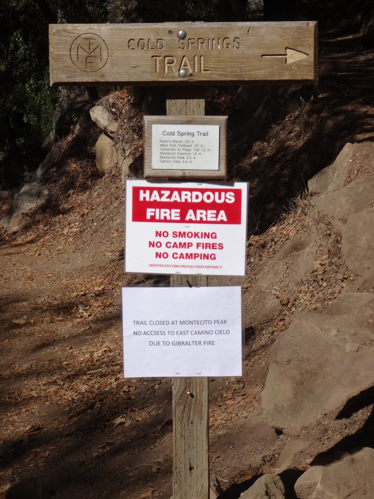
 Cold Spring Trail has reopened between the lower trail head and Montecito Peak only.  Trail between Montecito Peak and Camino Cielo Rd. is an active fire zone at this time and closed until further notice.  


Photos taken during the fire from the Riviera and from Cold Spring Trail  following the trail's re-opening.


Morning of 10/29

  Phos Chek dropped via jetliner


Not a worry in the world


 10/29 PM, Montecito Peak to the right


Cold Spring Trail on 11/1


View from Montecito Peak couple months back


Today


Closed portion of Cold Spring Trail as seen from Montecito Peak, 
multiple slides are just some of the issues on this section of trail


Fire fighters mopping up on the perimeter