Tuesday, July 21, 2009

Inspiration Point's New Look

I hadn't run the San Roque side, Jesusita to Inspiration Point route in at least six months. I knew it was trashed but not what I expected. Lots of garbage was piled up at the trail head. Who was nice enough to walk the burnt hillsides to pick up all this crap. There was a burnt out bike frame, a motorcycle, and dozens of broken bottles. I soon found out who was responsible for cleaning up this massive dump, Rick. Rick said he hiked here all the time and couldn't let all the trash just sit by the trail. The photos only show part of the mess, Rick had piles of bottles and cans and other debris bagged up and ready for removal. Thanks Rick!

It is nice to know that even with a devastating fire poison oak can survive. Most of all the bad poison oak areas on lower Jesusita are still going strong. Even ones that burnt up are actually sprouting again pretty rapidly. Maybe its not because it's a indestructible plant, maybe because it grows near the water. The shade along the trail is surprisingly intact while compared to upper West Fork and Tunnel Trails. The trees and brush are definitely singed in a lot of places but it looks like some of it might survive.

Past the last ranch along the trail, the trail leaves the canyon and the brush along with it. The area below Inspiration Point where the trail switches back and forth is in the worst shape. The trail is very loose in a many spots but still very safe. The lower sections of Jesusita it is hard to notice any difference in the trail itself from before the fire. This will certainly be a different story after the rains come and along with it, big problems.

Inspiration Point was clearly a battleground to try and stop the fire. There are small areas of brush still standing surrounded by large areas of nothing. Using dozers the fire fighters created a fire break at I.P. which heads directly towards the city. Probably 1/4 mile in length, this steep fire break ends at a steep overlook of burnt out canyons and almost above Spyglass Ridge Rd. and San Roque Canyon.

Looking toward the mountains Cathedral Peak is mostly bare of all its brush. It will be interesting to see the peak when that trail re-opens. FYI the drinking fountain near the last ranch along the trail is still working! Dave

Years of Garbage Piled Up At The Trail Head Good Samaritan Rick Picking Up After Everyone
5 Gallons of Broken Glass

New Signage at The Trail Head
Jesusita Trail Near the Top
Lower Jesusita Still Has Some Shade
Inspiration Point

The New Trail Extension At Inspiration Point Spyglass Ridge
Cathedral Peak
Tunnel Trail Zig Zagging In The Distance The Bridge Is Gone In Need of A Tow

Thursday, July 16, 2009

First Look- West Fork Cold Springs Trail

This was the first run I have taken on the West Fork in about 3 months. Just a little different than I last remembered it to be. Still the same was the poison oak just past the Tangerine Falls cutoff trail. Unfortunately the fire did not clean up the large section of poison oak that seems to always be encroaching on the trail in that area.

Once you get near the CS Water Tunnel it is almost 100% brush free until you reach Gibralter Rd. From there the trail itself is in pretty good shape, sure a little dustier than normal, and definitely much looser than before, but still lots of fun. Maybe the biggest difference from before is that you can really see the trail winding ahead up the canyon. The trail to Tangerine Falls seems to be intact but the trail leading to the top of the waterfall was pretty severely burnt.

Interesting things get uncovered when the vegetation is all gone. Former trails which have long been hidden are clearly visible again. Some of these trails were "illegal" trails created secretly and others were old sections of trail that have long been bypassed. Trails created by recent fire fighting hand crews are also very visible about the hillsides. A sure way to identify if a fire crew made the trail is when the trail goes nearly straight up the hillside and brush is cut to make a wide path. All the garbage including- cans, bottles, cars, appliances and other assorted junk is also now uncovered along the trail.

There are definitely areas of West Fork that will not do very well come Winter rains. Steep hillsides funnel down onto trail sections with little or no vegetation for protection. Just looking at it I could see big problems if the rains are anything but light this year. The same could probably be said for most any of the other trails damaged by the Jesusita Fire. Hope for the best but expect the worst.

Big thanks to all those that got out and help clear the West Fork of debris. It is evident that lots of work was put in to bring it into the condition it is in. Dave


The New Trail Head Signage
The Cold Springs Water Tunnel
The Water Tunnel Was Marked As A Fire Shelter For Fire Fighters
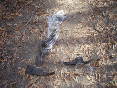
This Is What Happens When Fiberglass Handled Tools Are Left In The Fire
Newly Created Fire Line On The Steep Hillsides
The Trail
New Growth
The Switchbacks Which Are Now Visible
Once Hidden Tea Garden Cut-Off Trail
The "Dump" Area Near Gibralter Rd.
West Fork Canyon View

Wednesday, July 15, 2009

Three Trails Closed By The Jesusita Fire Re-Opened Today!

Dear Trail Users,

We are happy to inform you that Rattlesnake Canyon Trail, West Fork of Cold Springs Trail, and Jesusita Trail to Inspiration Point on the San Roque side only, are now open. Trails starting at the end of Tunnel Road at the Tunnel Trail Head will remain closed for now. Agencies wanted to warn everyone to be ready for possible unstable trail conditions and emphasized that staying on the designated trails was crucial. They also wanted trail users to know that trail closure status may change if the trails become unsafe or if it is found people are traveling "off trail" which will create erosion problems. Come Winter trail status may change due to weather conditions and it is a pretty sure bet that the trails will need work to make them safe for Winter and ready for Spring. Agencies also want everyone to be respectful of the neighbors living in area affected by the Jesusita Fire.

The trails could never have been opened this quickly had it not been for the huge turnout of volunteers that helped repair the trails on June 13th. Thank you to all that attended!

READ THE FULL PRESS RELEASE HERE

Thanks, The MTC

Wednesday, July 8, 2009

Montecito Hot Springs Property Up For Sale!

What would happen if the property where Hot Springs Trail and the Hot Springs themselves was sold? It's a possibility and a bargain at 18 million! Zoned for six parcels and a day use health spa facility this property has it all- including a bunch of really great trails. Let's hope that easements are created so these trails don't go away.

http://www.coastalranch.com/Properties/462hotsprings/Main.html

Thursday, July 2, 2009

7/1/09 Task Force Public Hearing/ Jesusita Fire Trails Re-opening Recommendations

Dear Trail Users,

If you were one of the 20 or so people who attended the public hearing at City Hall yesterday, you missed a long but informative 2 1/2 hour meeting. The opening and most anticipated subject was the trails affected by the Jesusita Fire and when they might be re-opened. The Task Force designated the agency staff from the USFS, County, and City to make recommendations, since they have the most recent information. Staff then recommended that Rattlesnake Canyon Trail and West Fork of Cold Springs Trail be re-opened. They recommended that Jesusita Trail to Inspiration Point from the San Roque TH be re-opened after fixing some problem areas. Because of sensitivity of neighbors in the Mission Canyon area, and construction work, trails accessed by the Tunnel Trail Head at the end of Tunnel Road were recommended to remain closed for now. The Task Force will revisit this issue at the September 2nd meeting and may make more recommendations then.

Note: The trails affected by the Jesusita Fire including Jesusita, Tunnel, Rattlesnake, and West Fork of Cold Springs are still closed but some are recommended to re-open.

2nd Note: Because of loss of vegetation on hillsides in the burn area, trails may be subject to future closures due to water runoff issues come winter.

We will post any trail openings on our website and of course will send out emails when those openings are to occur. It is without saying that these recommendations to re-open trails closed by the Jesusita Fire could not have been made had it not been for the large amount of volunteers that came out on June 13th to help clear the trails- Thank You!

Other topics of this public hearing included status of the FCT Recommendations. The Task Force spent a long time discussing the management aspects of the rec's which include assessing current trail conditions, developing a trail classification system, trails planning, policy, regulations and trail use designation. Staff also unveiled new trail head signage to be installed at all the local trail heads. See the new signage HERE.

Trail maintenance including the June 13th event was summarized as were other recent trail work events. The Task Force unanimously approved use of the UTAP trail assessment system but recommended that the company who created UTAP, Beneficial Designs, do the assessment. Several public speakers shared their opinion that volunteers not take part in the trail assessment. We agree this should be done by professionals as some of this data may be used for future trail access issues and we want this information to be as accurate as possible. Trail surveying may begin as early as October 2009 but some discussion remains on what data will be collected during the survey process.

Finally a schedule of public hearings was announced for the rest of the year. There will be two more meetings this year, September 2nd and December 2nd, both at 5:30 PM to be held in the city council chambers.

*Task Force Changes: The Task Force welcomed new members City Parks Commissioner Scott Burns and County Parks Commissioner Judith Dale who replaced Chair Steve Forsell and Commissioner James Hickling. Suzanne Perkins is now the chair and Beebe Longstreet is the vice chair.

Thank you,

The Multiuse Trails Coalition,

http://www.multiuse.org/

Wednesday, July 1, 2009

New Santa Barbara Front Country Trail Head Signage Unveiled

At this weeks FCTMJ Task Force meeting, newly designed trail head signage was shown to the public for the first time. These 2' x 3' (approx) signs will be mounted at all of the local trail heads and give information about trail use etiquette. These signs are part of the FCT Recommendations that are now being implemented. Look for these new signs at your favorite trail head soon!