Thursday, December 15, 2011

Sunday, December 4, 2011

QR Codes For Santa Barbara Trail Maps Have Arrived!

QR Codes or Quick Response Codes provide a quick link to maps of your favorite trails.  All maps are free and accessible with your smartphone.  This is the first time these maps have been made available via QR codes for Santa Barbara's Trail System and the first time anywhere using the Google Earth app.
Visit our QR Code Page for the codes and instructions: http://www.multiuse.org/qr.html

Above - A digital rendering of a QR code on Cold Spring Trail

Thursday, December 1, 2011

Winter Trail Damage Reporting Link

Got any information about Winter trail damage? Click on the following link and we will make sure the information gets to the proper authority for repairs. The more specific the info the better....which trail, where, and what... Trail Damage Link
From Winter Storm Trail Damage- 12/10

Monday, November 28, 2011

Red Rock 50 Trail Run 2011- Photos

The Red Rock 50 Mile Trail Race. What can you say about someone who runs 50 miles in one day over strenuous terrain like Santa Barbara's Front and Backcountry Trails? We will keep thinking of what to say while you enjoy the photos....

Above- Luis Escobar leads the charge down Cold Spring Trail


Tuesday, November 22, 2011

Rattlesnake Canyon Upper- Trail Project

Tin Can Meadow has typically been a muddy mess after rains
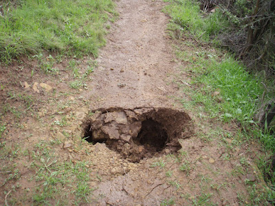
Not anymore, new water drains have been placed and will keep the meadow dryer

This tree was partially blocking the trail

Not anymore

Monday, November 14, 2011

Winter Trail Prep Has Begun!

Water Bar not working- before

Water bar after- ready for the rain

Thursday, November 3, 2011

The Red Rock 50 Is Coming!

The Red Rock 50 Is November 26th(Yes it's now 50 miles!). Contact Luis Escobar For Volunteer Opportunities: luis@reflectionsphotographystudio.com


Tuesday, November 1, 2011

Thursday, October 13, 2011

New Front Country Trail Map Online Now!

The all new, revamped Santa Barbara Front Country Trail Map is available now! This new desktop map is viewable on Google Earth and now includes the Arroyo Burro Trail and Island View Trail. More info has been placed in the icons and trails themselves and better delineation of trail vs fire road. Check it out today on our "maps" page!
http://www.multiuse.org/ge/sbfctsmap.kmz


Friday, October 7, 2011

Tunnel Trail Rut Repair

Wet soil makes for the perfect condtions to get out and do a little trail repair. The "rut" on upper Tunnel Trail has been an eyesore and an obstacle to those who frequent the trail for the last year. The rain created the rut was deep enough that people created a secondary route along the upper hillside.

The solution, remove the weeds filling in the actual trail and then fill the rut with rocks and soil to make the trail usable again.
Link to photos


Step One: Weed Removal


Step Two: Fill In The Deep Rut


Step Three: Enjoy Your Repaired Trail


Thursday, September 29, 2011

National Public Lands Day, 9/25/11- Photos and More

National Public Lands Day 2011 was a success! About 50 volunteers from the community came out to help clean up lower Tunnel and Jesusita Trails. Ourselves along with SBMTV, City of SB, USFS, and REI helped sponsor this event. The photos and more info here


Chris Orr from SBMTV gives the safety talk before hitting the trail

Wednesday, September 28, 2011

View From Above The Clouds

There was sun somewhere in Santa Barbara today....high up on the trails. Here are a few pics from Arroyo Burro Trail this afternoon.


Inspiration Point peaking through the clouds


View down the steep ridge on ABT


Goleta Mountains and Clouds


Saturday, September 10, 2011

Monday, September 5, 2011

Re-Discovering The Franklin Trail


The Franklin Trail, it's the newest old trail in Carpinteria. Over 100 years old it runs from behind Carp High to a saddle on Divide Peak Rd then down to Jameson Reservoir. Unfortunately property lines prevent usage at this time but...... a group is currently trying to get the lower Franklin Trail re-opened and is looking for donations make this happen. Visit "the Friends of Franklin Trail" website to learn more. Once the lower section of the Franklin is accessable, traveling from Carpinteria to Jameson Reservior will again be possible.


I decided to take a look at the upper portion of the Franklin Trail via Divide Peak Road and the Island View Trail. The upper trail head of the Franklin is a little more than 9 miles from Romero Canyon's upper gate. Questions I had were, what is the feasibility of making a loop out of Franklin- Romero Trails, I also wanted check the condition of the upper trail, and get GPS mapping done for the connection route.

The trail to Franklin is very similar to McKinley Peak in distance and steepness. The distance between the gate and Franklin was a little over 9 miles with approx 1900 ft in elevation gain and 1200ft of elevation loss. The conditions are steep in some sections but the views towards Carpinteria and beyond are well worth the effort. (I previously mapped the Island View Trail- approx 3.5 miles in length, it connects the upper Romero Fire Road/Camino Cielo to Divide Peak Road. This trail is extremely steep)

After cycling along the road in the 90 degree heat for a couple of hours I arrived at a saddle where my GPS told me the Franklin Trail Head should be. No signage is evident and no real trail was visible. I wasn't convinced that I was in the right place until I walked up the hill and took a look back at the saddle where I could make out a faint trail heading down towards Carp.

Definitely an exploration that warrants long pants and more energy than I had this day. When and if this trail gets re-opened it will be fun to connect this upper section of trail to the lower trail below. Look for a maintenance project for this upper trail in the near future? D


Panoramic of the Upper Franklin Trail View of Carp and the islands from the Franklin Saddle
Divide Peak Road

Click Here For The Photo Album


Tuesday, August 30, 2011

Federal Cuts Threaten Outdoor Recreation Industry

From the Independent: http://www.independent.com/news/2011/aug/30/federal-cuts-threaten-outdoor-recreation-industry/

Lois Capps Addresses Roundtable of Area Stakeholders
Tuesday, August 30, 2011
Monday proved to be a typical sunny Santa Barbara summer morning – the Santa Ynez mountains were clear and bright and the ocean stretched out towards the Channel Islands, only slightly obscured by fog. It was a perfect day for Congressmember Lois Capps to pay a visit to Horny Toad Activewear's headquarters on West Mason Street to host a roundtable discussion with representatives from the area's outdoor recreation industry.
The talk was spurred by the threat of imminent budget cuts to conservation programs, such as the Land and Water Conservation Fund. As a point of reference for residents who may not realize how such funding impacts Santa Barbara County, many popular parks were acquired and have been maintained with federal money. Shoreline Park, for instance, received $425,000 to acquire and develop it. Carpinteria Bluff Park was acquired for $214,000. If the proposed reductions take place, the Department of the Interior would be funded at $9.9 billion, which is seven percent below last year's level.


Congressmember Lois Capps address concerns of area outdoor rec representatives
In California alone, outdoor recreation contributes $46 billion annually to California’s economy and supports 408,000 jobs across the state. The industry generates $3.1 billion in annual state tax revenue and produces $28.1 billion annually in retail sales and services. Nationally, outdoor recreation revenue contributes $730 billion to the U.S. economy and supports nearly 6.5 million jobs.
In order to highlight the impact that these cuts would have – not only on the many nature preserves and parks in California but also on the companies whose business is outdoor recreation – Capps invited stakeholders to come and share their thoughts. There were over 20 people present, including First District Supervisor Salud Carbajal; Christina McGinnis of the Environmental Defense Center; Dan Fontaine with Wilderness Youth Project; Chris Orr from Santa Barbara Mountain Trail Volunteers; Hans Cole, Patagonia's Environmental Grants Manager; Kim Kimball, Gaviota Coast Planning Advisory Committee chair; Michael Cohen, owner of Santa Barbara Adventure Company, Michael Feeney, executive director of Land Trust of Santa Barbara County; and Carla Frisk, Trust for Public Land manager.


Hans Cole, Patagonia's Environmental Grants Manager
Seated in Horny Toad's spacious and modern headquarters, the delegates mulled the impacts these budget cuts would have. “Recreation is big business,” said Capps. “It represents hundreds of billions of dollars in this country, and without protected public lands this slice of the economic pie would not exist.” Although the potential impacts were frightening to all present, the mood was not one of fear but of resolve. Cohen spoke about how his company is currently hiring more people to fill the demand for surf trips and boat adventures to the Channel Islands. He called tourism Santa Barbara’s “last viable industry.” Cole said his organization “wouldn’t have a business if it weren’t for all this amazing public land.” It is no accident, said Capps, that corporations such as Patagonia are headquartered in the area given the natural beauty of the 23rd Congressional District.
Capps addressed attendees' concerns and spoke to the incredible sway certain groups seem to have over Washington. Yet she also reminded that this was taking place not only in Washington but also in their very districts, and she would make it her “mandate” to speak on the behalf of local outdoor recreational companies. In turn, she encouraged her constituents to reach into their own communities, to make a national voice heard, and to educate future generations about the significance of the natural world and turn this education into advocacy.

Tuesday, August 23, 2011

Front Country Trail Turtle

This little guy was spotted today leaving the San Ysidro Creek heading up the super steep fire road towards Hot Springs. Let's hope he makes it!


Up Close and personal with a SB Trail Native


It's a long steep road ahead

Saturday, August 20, 2011

Bike Racks At The Trail Heads? It's Time

Why not promote a "greener" way to use the trails? Instead of driving to use your favorite trails how bout biking there then doing that hike. Some are already doing just that but the lack of bike parking forces cyclists to get creative when it comes to looking for a place to lock up their rides. Tunnel and Romero have gates near to the trailhead which allow users to lock but all the other trails do not. We have approached the Santa Barbara Bike Coalition and SB City Parks with the idea of placing racks at your trail heads and both groups seem interested. Hopefully this "additional parking" will be placed at your favorite trail in the very near future.
(All photos taken in the Tunnel Trail vicinity)


Sign posts, when used propely can make fine bike racks


One trusting cyclist left this bike unlocked at the Trail Head


Bridge or bike rack? You decide

Street sign or bike rack? You decide
People get creative when securing their bikes